The Rochester Police Department is announcing a new crime mapping feature on its website, giving residents real-time access to information about criminal activity in the community.
The new tool is part of the department’s Crime Scene Intelligence (CSI) system, which provides CompStat analysis, crime mapping, data collection, trend identification, hot spot visualization, and chart and graph generation. According to Chief Gary Boudreau, these features enhance the department’s ability to track and analyze crime patterns across the city.
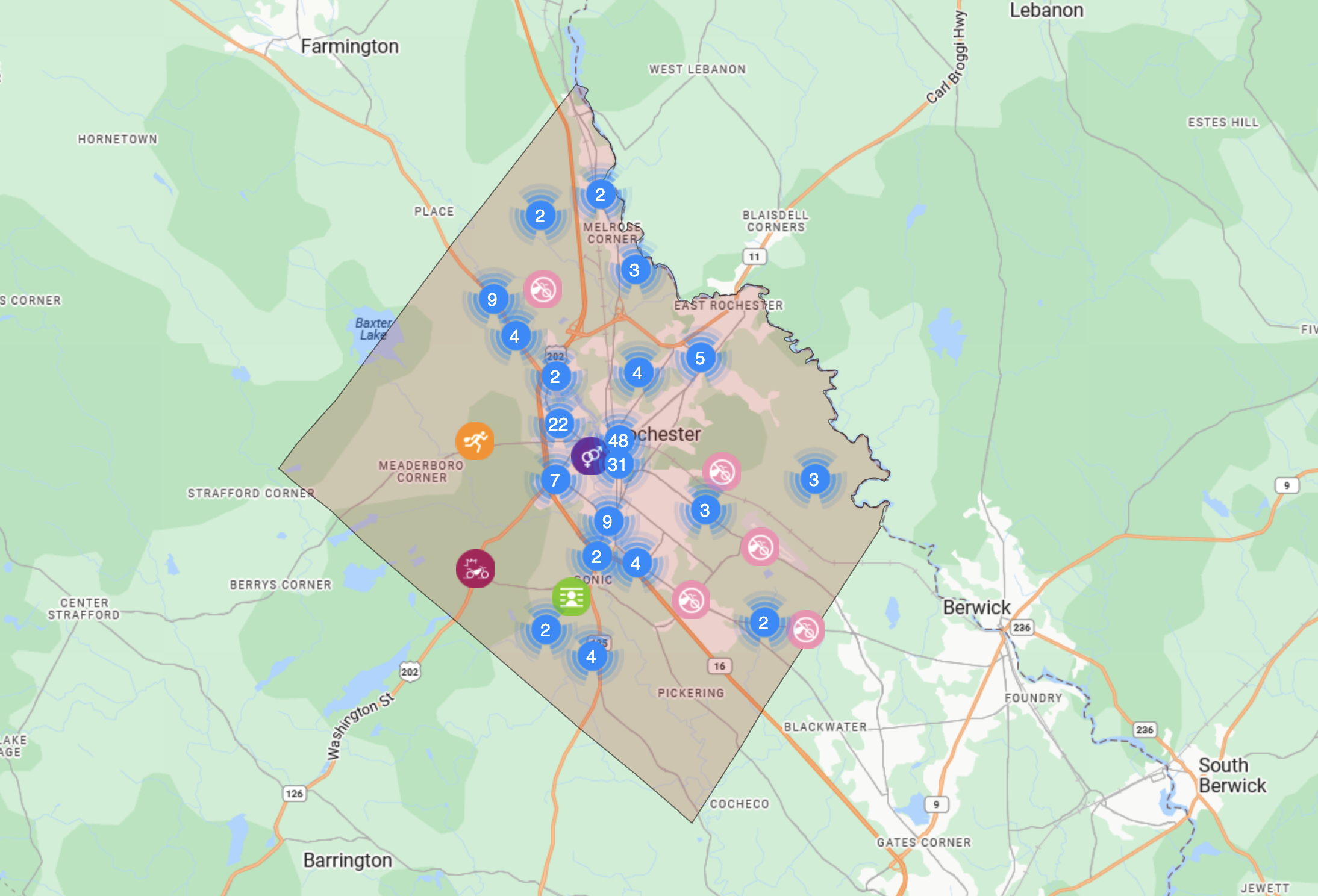
Using Geographic Information System (GIS) technology, the crime map displays incidents on an interactive map, helping both law enforcement and the public visualize where certain types of activity are occurring. The tool is designed to improve transparency, support crime prevention efforts, and help residents stay informed about what’s happening in their neighborhoods.
Common offenses shown on the map include arson, burglary, disorderly conduct, driving under the influence, fraud, theft, motor vehicle accidents, narcotics violations, assaults, robbery, and other incidents. Each pin on the map provides details such as the type of crime, date of the incident, location, and case number for reference.
“Our goal is to give community members easy access to accurate, up-to-date crime information,” said Chief Boudreau. “By sharing this data, we can build stronger partnerships with residents and work together to keep Rochester safe.”
The crime mapping feature can be accessed on the Rochester Police Department website at police.rochesternh.gov.